August/September 2024
A Brand New Bike
We find our way back home to Alabama to settle in for the winter
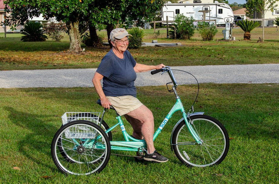
A few days ago, we bought Kathy an adult tricycle, quite spiffy and with a nice basket for carrying stuff. It’s a lovely shade of pale green (“mint”, the man said), and she is delighted. At the moment, it is without a name. Do you have one you’d like to suggest? Early contenders are Mitzi, Sea Breeze, and Trikesey (pronounced Trixie). We’d welcome your thoughts.
In the meantime, on to our latest message from the road.
This part of the story begins in August of this year, as we are finishing up a lovely 2-1/2 weeks of peace and quiet at 7000 feet in the Bighorn Mountains in Wyoming. This was our first stay of the summer in our “Summer House” place and as always we felt like we could have stayed forever. But we’d made plans to spend some more time with our friends in Utah so we were headed back there. Gary and Carol are old buddies, we like sharing adventures, and Rick and Gary continue to enjoy working on projects in the woodshed there — oops, we mean to say “in the lovely and well equipped woodworking shop there”. Oh, and it’s great to splash around in their pool in the hot afternoons. We’d been having varied weather up in the mountains, from in the 90’s to down in the 40’s — rain, hail and clouds— then lots and lots of sunshine. So, more of the same in Utah, but at lower elevation and higher temperatures.
Our first night’s stop going west in Wyoming, we stayed right at the top of South Pass, on the Continental Divide at 8300’ elevation, along Highway 28 heading south from Lander. It’s a great place to stay, although exposed to more wind than somebody might want. There were rabbits munching their way along, birds checking up on us, and plenty of cows.

This is an old mining area, and there are plenty of places to explore nearby. It was super; we really like the Continental Divide. I’m not sure why, but the concept of the CD appeals to us — the Divide tells you which way the water flows and marks a terrific crossing the continent sort of moment. It’s a milestone like crossing the Mississippi River.
But we weren’t following rivers at this point; we stayed on the highways. After dropping down Highway 28 until it reached I-80, we planned on heading west through Evanston, and then on into the Ogden, Utah area.
However, there were lots of flashing signs warning about heavy storms and high winds heading west, so we figured the best thing would be to stay the night in town. We waited it out then headed into Utah the next morning.
We spent a quiet, pleasant week with Gary and Carol, building, swimming, working on projects, and sharing the cooking. Kathy picked all the ripe peaches off their trees and made us a great pie. The apples were looking great, but not quite yet ready for picking. Our friends’ daughter, Abbie, lives nearby, and has two delightful and energetic dogs to both keep her company and to allow her to show how really excellent she is in training them for competitions. Part-way through our time there, Carol and “the kids” headed out for a regional competition (they were quite successful in their events and all of them subsequently headed for the national competitions in Missouri — go Abbie!) It was lots of fun to watch them romping around, and we all had some difficulty making the dogs understand that there are times when the pool is just for the two-footed folks.
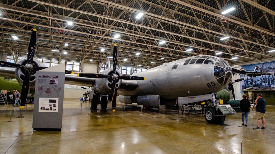
While in the Ogden area, one day Gary & Rick ventured out to visit the Hill Aerospace Museum on the grounds of Hill Air Force Base. This proved to be a very nicely organized and roomy space displaying plenty of nice airplanes. There were a few from the vintage period, a replica of a Wright flyer and another of a Curtiss Jenny; then several WWII fighters and bombers. The bulk of the collection, however, was from the Cold War and Modern eras. One of the main problems one finds when visiting airplane museums is a lack of space — planes are really big and not conducive to close placement. This museum does have enough room for the planes on display to be seen and enjoyed. You can see more photos of the museum at our Motor-Museums.com site.
By now it was time to move on again. A traveling friend was coming through the area and we wanted to catch up with her for a few days. So, do you remember the South Pass area? We met up with her up there, this time in a small campground a few miles further north from where we’d stayed a couple of weeks earlier. It was also the place where some new friends (Tiger owners) were volunteering for the summer — at the BLM campground called Atlantic City. It was a lovely spot, nestled among the aspen trees and nice and cool; happily, there were no casinos. The bunch of us had a very good time.
As you may have guessed, we were taking a leisurely, meandering route heading east. We had no plans to be any specific place until late September. So where were we going? — Back into Wyoming.
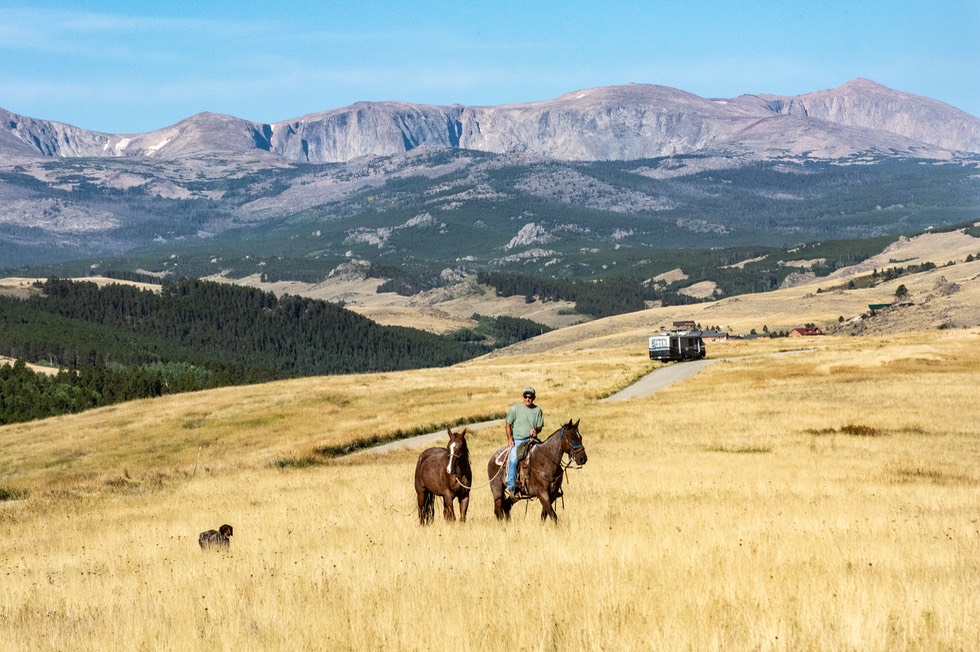
It is turning out that the Bighorn Mountains are our go-to spot when we don’t need to be somewhere else. We stayed almost two more weeks. It’s quiet, and cool breezes are the norm. We rarely see more than 2-3 other rigs the whole time we’re there, and the cows are generally way off in the distance.
Not today! When we arrived, the area was filled with cattle enjoying unusual freedom to roam.Then the next day a group of cowboys arrived and “moved” the critters back to a different area of the hillside and we were alone again. It had been great fun watching them do their job — between the horses, the dogs and the cowboys in charge it all went very smoothly. We think the dogs had the most fun.
Eventually, after an additional 12 days on “our” bluff we were starting to get a bit restless; we were also running a little low on food and water, plus needing a few purchases. So we dropped down into the town of Buffalo intending to run errands and to dump our tanks and take on fresh water.
That was the plan, but as it turned out, when we had made the 2,000’ drop in elevation down to town, it was so very much hotter that we were immediately miserable; we decided in our usual spur of the moment fashion, “Hah! No Way, José!!”. We needed to keep the A/C going, get on down the road and try and find somewhere cooler. So we skipped the chores and on we went, heading east toward the town of Gillette. The lovely thing about Gillette is that it’s out onto the prairie, is at a little higher elevation and we have a spot near the edge of town where we like to hang out for an overnight. It’s usually cooler and a lot breezier. And there are pronghorn in the neighborhood.
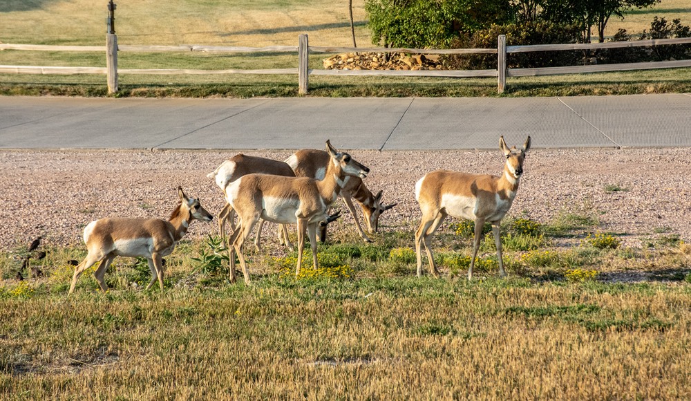
We’ve stopped here several times over the years, and there has usually been a troupe of pronghorn antelope in residence. And there they were! They’re a bit skittish, so you don’t try to get close, but if you just stay in the RV and hunker down, by mid-evening they will be there with you, munching away on their evening meal. They remain wary, but not so’s they take off. And they are quite interesting, those critters.
The next day we continued east across the Wyoming prairie, and then suddenly we came up out of the prairie, into the trees of the western edges of the Black Hills, past Sundance and not far south of Devil’s Tower, and on into South Dakota.
When you cross into SD on I-90, you soon start driving through a series of well known locations — Spearfish, Sturgis, Rapid City, Box Elder, Mt Rushmore — all part of the Black Hills. All delightful and enticing. But even sooner, with a small deviation, you end up in Belle Fourche. Strange name, it would seem. Belle Fourche means “beautiful fork”, so named by French explorers. Lots of places out here on the plains were named for landmarks along the trails. The town was at the confluence of two important rivers, and was, apparently very lovely. It’s in nice country and has some nice camping locations. We’ve often stayed the night, and can recommend it as a good spot for exploring.
But this time, on we went. It continued to be very hot and we were heading for the air museum in the town of Box Elder, a bit further along on the east side of Rapid City. Sadly, we’d arrived at a time when the museum was closed and would not be open for about 3 days. We were pretty disappointed; the museum is supposed to be very interesting and has been recently refurbished. Too long to hang out in the heat, so on we went. Another time, we said.
Our goal was to drive across the state and end up in Sioux Falls. We had three goals for that destination, and now had a bit of a time-frame to keep in mind. As it turned out, we kept adding events as we went along, keeping ourselves quite busy. Our end game (the first goal) was to be in Sioux Falls on September 20 for the first day of early voting (SD is one of three states that began the early voting period 45 days prior to the election — earliest in the nation). We made that goal without having to scramble, and actually enjoyed ourselves very much. As it happens, that’s two Presidential elections in a row we’ve done this.
But let’s keep organized here. Driving away from Box Elder, we were heading east to the Missouri River, which moves north to south across the state of South Dakota, bisecting the city of Pierre, the state capital. Pierre is fun, has lots of history, and sits on the east side of the river, somewhat north of I-90. But, for us, we wanted to stop in Fort Pierre, which is the smaller part of it all and which sits directly across, on the west side of the river. Fort Pierre is a continuation of that history, has retained its small size, has a lovely, small city park (with an inexpensive, full-service campground), and is situated right on the banks of the Missouri. Way cool. Actually rather overwhelmingly hot — but the park provided the electricity we needed to support our air-conditioning equipment. YES!!!!
We spent 3 days there, wandering the area in the mornings, staying indoors in the worst heat of the day, and enjoying the very pleasant evenings. A terrific spot, quite hot during the day but with good breezes off the water, and very pleasant mornings and evenings. A big bull-riding event was on for over the weekend, so we left on Friday to give someone else a chance at a site. But we could have stayed for a month — it was marvelous to have our A/C available!
And the very practical reason for stopping there? Okay, you may want to take notes here. Kathy needed to renew her SD driver’s license (the second goal). There are state residency requirements for full-time RV travelers — you must be able to prove you have stayed in-state for at least one night in the twelve months preceding when you are renewing you license. Somewhat involved, but not impossible.
Just before leaving that last morning, we stopped at the business offices for the town and got a receipt for the camping costs. This is what we would need to prove we had stayed those nights. We Love SD.
Heading east from Fort Pierre we stayed well north of I-90 as the countryside became more “cultivated prairie”. Sunflowers, corn, soy, with hay bales along the side of the road, tiny towns consisting mostly of silos…flat, flat, flat. But very little cattle.
Finally approaching Sioux Falls, we had several days to wait. We headed for one of our favorite spots, just outside the small town of Carthage. There is open camping (free) next to East Lake Carthage, which runs through the area. It’s quiet, lovely, and right now it was totally vacant. We’d been here at other times of the year, when it was far busier. One day I saw a pheasant peaking out from the ground cover in the trees. (No photos, just plain beauty to enjoy. ) Otherwise, just us. Swell!
We spent 4 nights there in Carthage. It was the quietest, most pleasant time we’ve ever had at this spot. No other campers. No one coming by except to see that we were still there and to empty the trash. And, it had cooled down enough that we no longer needed electricity. Just swell.
We’d been in touch with friends from Indianapolis who were heading west, and now found they would be coming through the area in a couple of days (our third reason). So we packed up and went off to intercept them at a road stop on I-90 outside Sioux Falls. Had a swell visit, waved them good-by, and off we went into the city while they continued west toward Yellowstone. Over the next couple of days Kathy went through the drill and got a new driver’s license (equally lousy photo) while Rick arranged for and had installed some new tires for the motorhome.
Then, our last day in Sioux Falls, we voted in person at the County offices. They were preparing to mail out almost 5,000 absentee ballots quite shortly. There were plenty of people in line to vote in person starting that morning. It was all rather keen! We were told that if our absentee ballots showed up erroneously, to please destroy them (they did, and we did).
After voting, we hit the road; having taken care of chores, we could start on down towards Alabama, where we will spend the winter. We had planned a route that would let us wander through a fair amount of the midwest while still heading towards our winter home. This would be the fun part of our trip.
Our first night’s stop was straight south of Sioux Falls, down to the small city of Vermillion. We stopped at the Lion’s Park on the southern edge of town for Friday night. We’d last been here shortly after Covid hit in 2020. It’s a nice little spot with hook-ups and lots of green grass and trees and playgrounds, and plenty of squirrels.
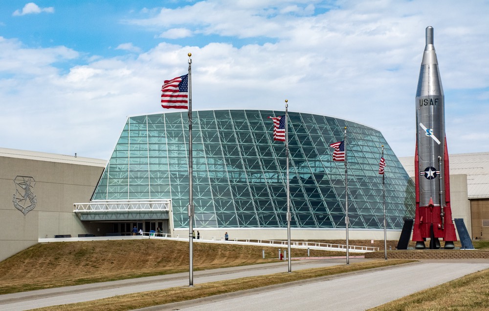
The University of South Dakota football game was the event of the day on Saturday afternoon. Lots of folks dressed in red, head to toe, and heading for the stadium even though it was only 10:30 am. On our way out of town we turned south on Hwy 29 down through Sioux City, Iowa and then into the Omaha, Nebraska area on our way towards the SAC Air museum in Ashland, a bit southwest of Omaha.
Driving south through this area we crossed the Missouri River at the outskirts of Council Bluffs, Iowa; the road then took us further east, so we drove through the hills, thinking about how Lewis and Clark would have been astounded at the look of the area these days.
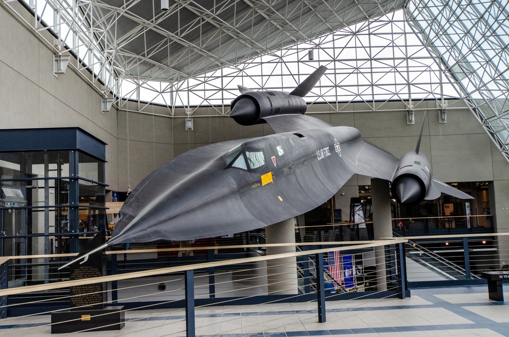
Some of you may be young enough that you don’t remember the Strategic Air Command; a division of the Air Force charged with keeping nuclear bombs in the air 24/7 back in the 50’s and 60’s. Scary times back then, for sure. Rick had long looked forward to visiting this museum in hopes of learning more about the history and operation of SAC. Alas, the visit turned out to be a bit of a disappointment.
We found the museum to be overcrowded with planes; B-52s and B36s are really big airplanes and the fact that one of each was on display inside the main hangar tells you a lot about the size of the building. Sadly however, it was pretty hard to focus on and appreciate any one plane because of the overhanging wings from others around it. The lack of information about either the planes or the mission of SAC itself was also a major disappointment. This story deserves a better telling. The movie theater happened to be closed to the public the day we visited as it had been rented out to a private function, but we didn’t see any indications of films that might otherwise have been available for viewing. We have to classify this museum as something of a disappointment, but again, you can see our photos over at Motor-Museums.com.
We finished up, then headed east again, back across the Missouri into Iowa. This jaunt was a regular tangle of bouncing back and forth across state borders.
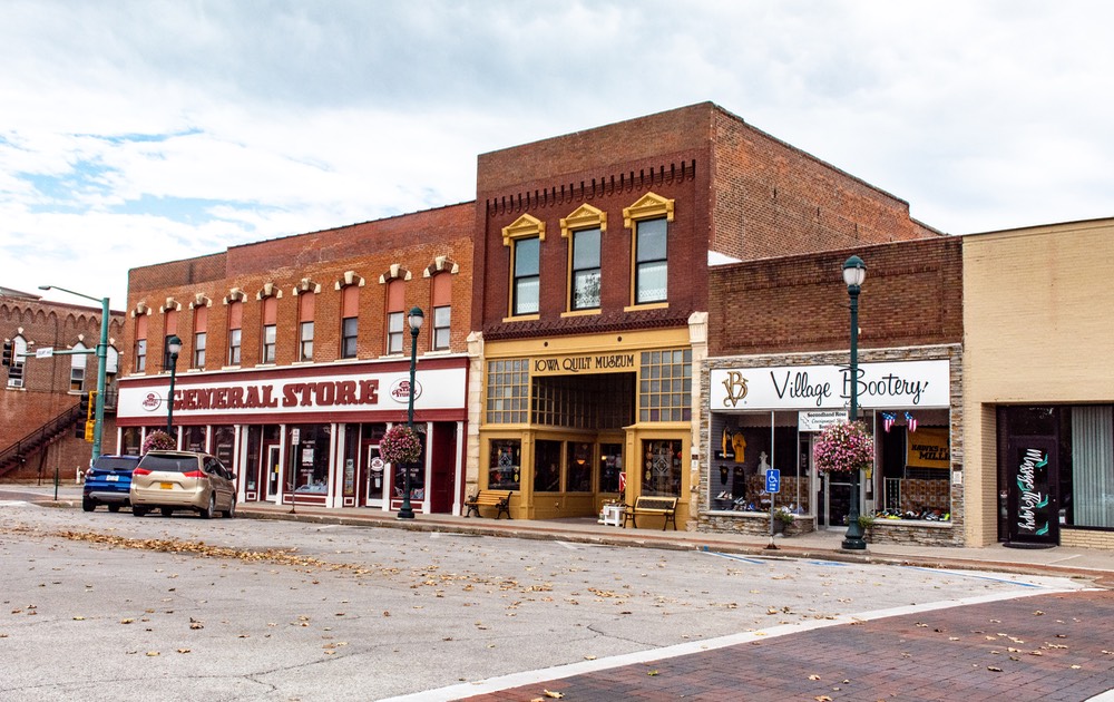
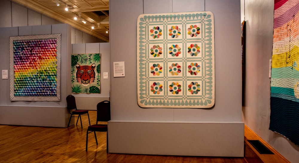
Our goal for Iowa was to be able to stop in Winterset so Kathy could visit the Iowa State Quilt Museum, which was both charming and low key.
Winterset is a charming, small town, with plenty to enjoy. We stayed at the local fairgrounds while we visited the area, which is lovely. Not only is the state quilt museum a small gem, but it’s right in the middle of town.
From there you can begin a tour of the Bridges of Madison Country which was filmed here; two of the bridges are very local while others are spaced around the county — “turn right just past the big yellow dog” — for those who have seen the movie. Also it is the home of John Wayne, complete with a museum and the house he grew up in. As did George Washington Carver (in a different house).
We found we were really enjoying Iowa as we wandered along; just as we always have on previous trips. Quietly lovely; the small towns were clean and neat with courthouse centers, lots of trees, etc. No doubt a great place to live if you don’t mind the winters.
Then further south, down into Missouri. In Macon we saw a sign for an “exotic” sale (clue: it was in front of a livestock barn at edge of town). We suspected they were having a sale of unusual species of farm animals, e.g., llamas and alpacas), but what do we know. We’d run into other such signs in Texas, where Exotics tend to run more to Zebras and other antelope species.
We spent a night in the small village of Mansfield, which had a pretty little park, a lovely square with gazebo and lots of flowers. The Laura Engels Wilder’s home and museum are here. We chose to stay the night along the square. Unfortunately it was right next to the train tracks and they stayed very busy through most of the night. We wished we’d not stopped, but c’est la vie.
On to Arkansas. GO RAZORBACKS!!! Passed through the tiny town of Evening Shade — really charming. And Cave City had pork skins for sale beside the road — you couldn’t miss it, such a pretty pink wagon. We managed to stay clear.
Got to Searcy, Wednesday for a Thursday appointment for a follow-up on the work they’d done this spring. They took care of us that afternoon and then welcomed us to stay the night anyway. Great staff, really sweet fellows. Went on the next day. We were now heading towards Mississippi. So; drifting toward the eastern border with Arkansas. As we got further south they were harvesting cotton and rice, etc.
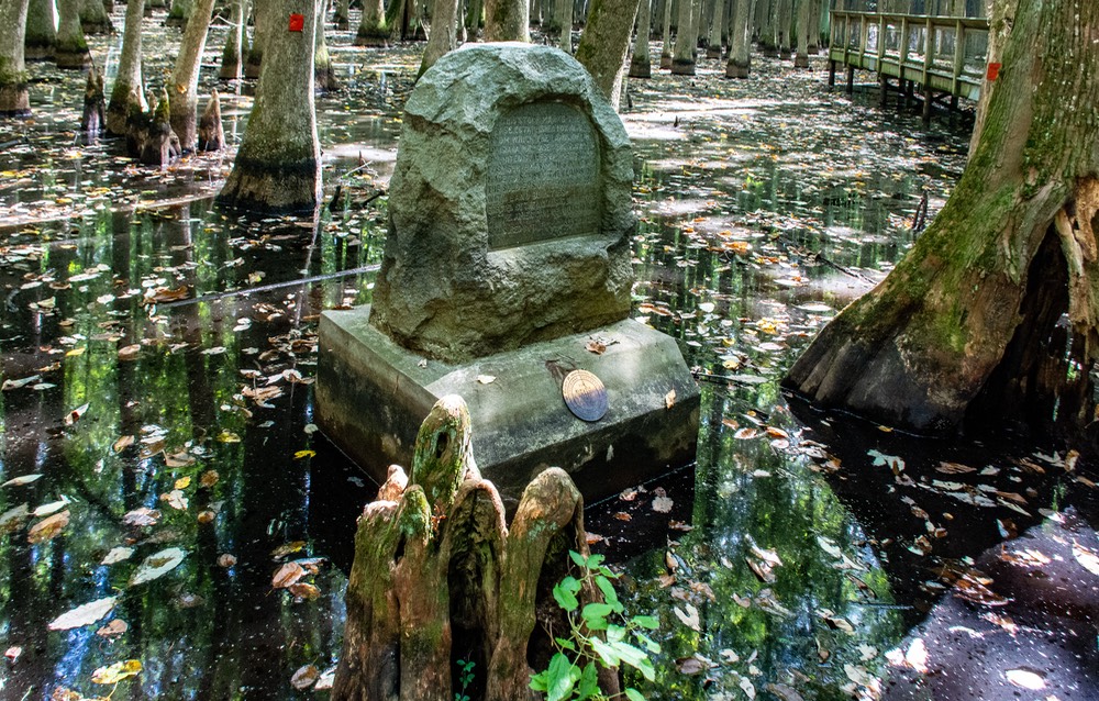
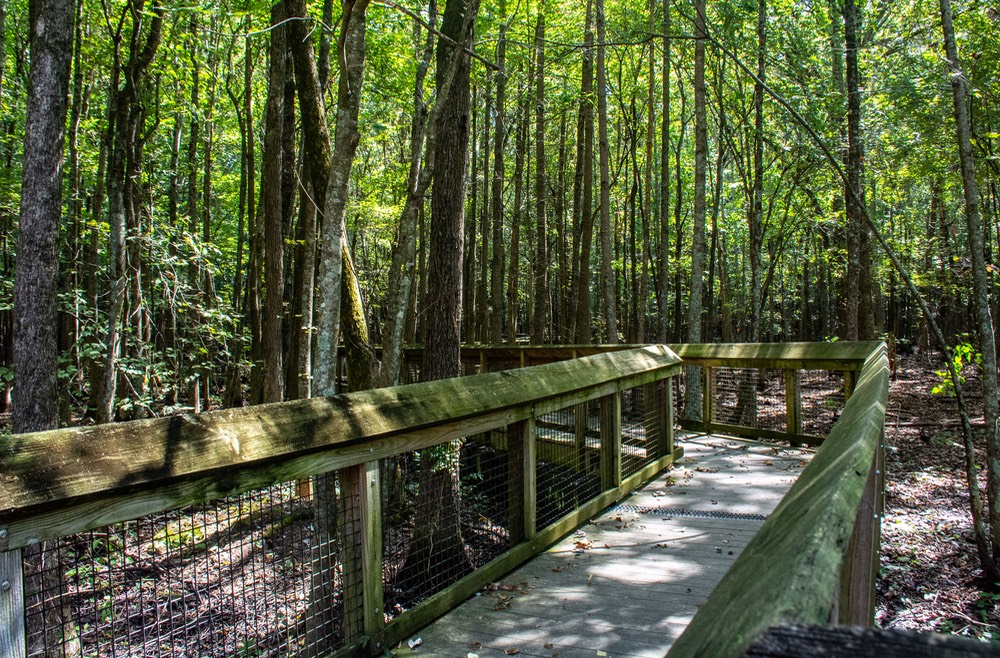
Stopped at the Louisiana Purchase Historic State Park, near the eastern edge of Arkansas. Been here before, although many years back. Definitely swampland. Very low key, just a boardwalk out into the swamp to a spot where this important monument had been erected.
So? What’s the big deal? Well, you know all those plots of land all across the western United States? They didn’t just show up; they were plotted. And where did they start? In the Mississippi River Valley at this longitude and latitude in what later became southeastern Arkansas. It’s amazing to think that, back in the early 1800’s the surveying was done to lay out what was to become the entire western US. How they did all that is a total mystery to us, but we can say we’ve been to the spot where they began the task.
After visiting the historic park, we stopped for the night at a spot we like at the visitor’s center in Helena, AR and then crossed over into Mississippi the next morning. More and more cotton. We were now headed for Enid Lake and dam and the Army Corps of Engineers Park there. Why? We were heading east toward Knoxville, Tennessee, but Hurricane Helene was about to hit and we felt we needed to stay west of as much of the activity as possible. Once again we were waiting out a hurricane. As you know, Helene was absolutely horrible; but it stayed away from us (and our campsite in Alabama as well; we were very lucky.)
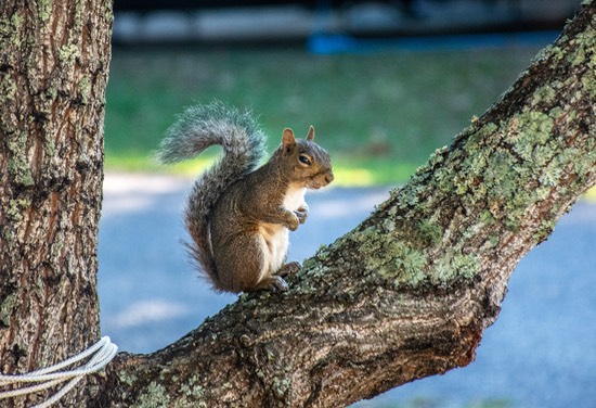
We were camped right on Enid Lake. We were joined by squirrels, eastern bluebirds, and even a deer. We had one night of pretty heavy rain, and then the weather started to clear after the hurricane finally moved on further east. Then it got pretty sultry… about normal for Mississippi in September.
When we left we drove through Oxford and Tupelo, very familiar country; Shiloh Civil War Battlefield is a bit north of here. Crossed into northern Alabama for a minute, as we followed the Tennessee river heading northeast of Huntsville. Interestingly, north of Scottsboro we drove past the Bellefonte Nuclear Power plant, rather startling to us. Who knew there was a nuclear power plant in northern Alabama?
Suddenly we were in Tennessee, crossing its namesake river. This is a very lovely, historic area, home of the Chattanooga-Chicamauga battleground of the Civil War and its famous Lookout Mountain. We would have loved it if the fall color change had begun, but no such luck. We were a few weeks too soon, perhaps because of the strong rains and hot weather.
The road was taking us into the Chattanooga area; oops, into Georgia for a moment … and now the Eastern Time Zone, and back into Tennessee. Very Busy Time!!! Stopped for a bit of a collapse in a rest area … ”No Livestock Unloaded.” Guess the critters were going to have to hold it for a bit longer.
And then we arrived in Knoxville, where we had family waiting for us, and where we stayed for several days visiting while we enjoyed the countryside, the southern cooking, and a very nice family gathering.
Being very busy people, after a couple of days the group split up to take off for what was next on their schedules; we started working our way back down through Alabama to our winter home setting at the Plantation campground near Summerdale and the Gulf Coast.
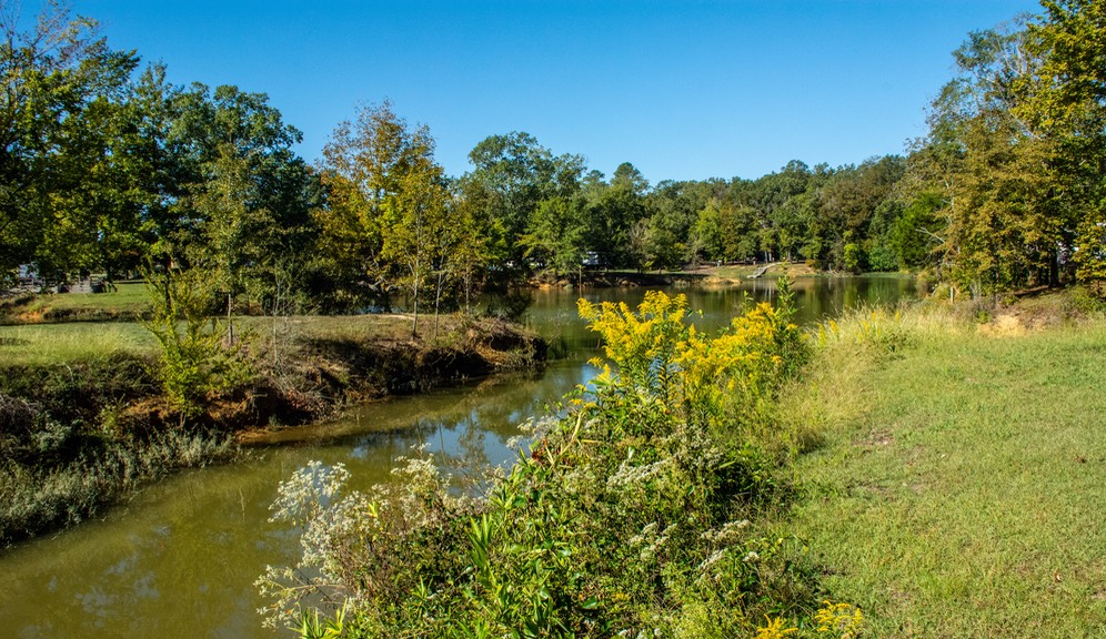
After a couple of long (for us) days’ drives, we decided to stop for a bit at the Foscue Creek Campground, part of the Corps of Engineers camping area near Demopolis, Alabama, along the Black Warrier-Tombigbee Waterway. Even before arriving, we’d learned that the next hurricane to be coming through the area was expected to be even more vicious than Helene, and so we hung out for a few days while Hurricane Milton made up its mind whether we would have a rough go of it if we decided to keep on driving. We’d stopped here earlier in the spring, and were delighted to be able to make a return trip so soon. It was absolutely beautiful in the Demopolis park — just about perfect. We had plenty of trails to walk, squirrels for company, and balmy weather.
While enjoying ourselves, we thought back a bit on this year’s wanderings. All told, we’d covered 12,000 miles and been in 20 different states, starting in April: Georgia, Arkansas, Mississippi, Oklahoma, Texas, New Mexico, Arizona, Nevada, California, Oregon, Washington, Idaho, Utah, Wyoming, South Dakota, Iowa, Nebraska, Missouri, Tennessee and back to Alabama!
Eventually Mr. Milton decided Alabama wasn’t going to get a visit, so we moved on down the hill and arrived back at our “winter home” at the Escapee Plantation out in the countryside west of Summerdale. Here we will remain until next spring — maybe April, maybe May. Have made no plans for the interim other than working out at the 'Y' and enjoying our southern home. You might think about stopping by for a visit. It’s nice around here in the winter time! And we have alligators without you having to visit Florida! Come on by!
Best wishes y'all, from Rick, Kathy and… what’s her name.
You’ll want to visit the Photo Page for this story to enjoy more pictures.